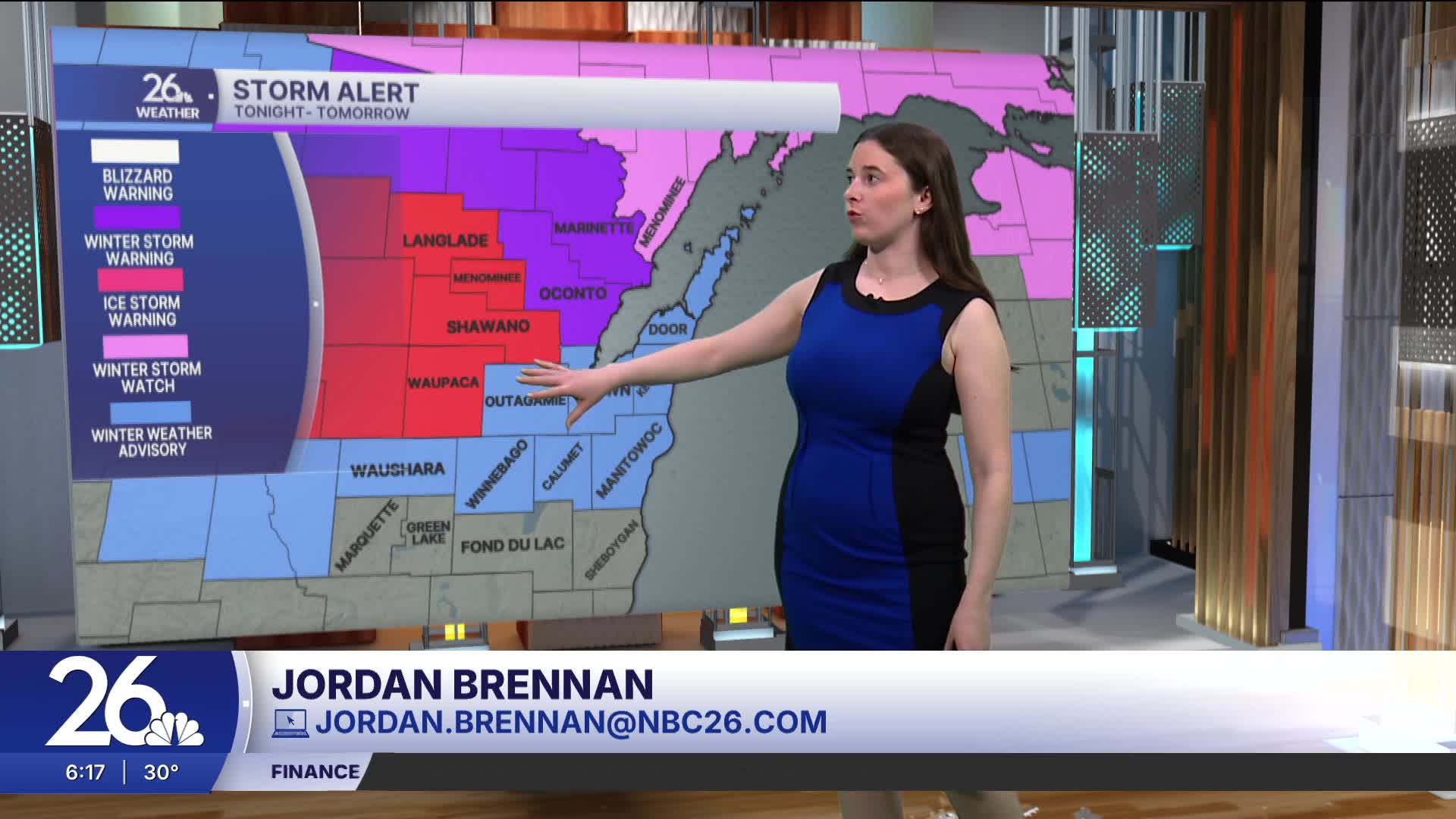


While today will be cool and quiet, the weather will become more active tonight. Ice storm warnings, winter storm warnings, and winter weather advisories have been issued for our counties from tonight into tomorrow.
Sleet and freezing rain will begin late tonight, with the highest ice accumulations expected in areas under ice storm warnings. These areas could see between 0.25–0.50 inches of ice. Other areas can expect between 0.10–0.25 inches of ice accumulation, along with sleet. Slick roads will be a concern, and some tree damage or power outages are also possible especially in areas with higher ice accumulation.
By tomorrow morning, warmer air at the surface will move in, leading to a transition to rain. By the afternoon, there will be a chance for thunderstorms, a few of which could become severe. Damaging winds, hail, and heavy downpours are possible.
There is another chance for rain Friday night into Saturday. All of this precipitation over the next few days may lead to rising river levels.
