

Our first round of winter weather started last night. Winter Storm Warnings and Winter Weather Advisories have been issued for the northern half of our counties, while Wind Advisories and High Wind Warnings have been issued everywhere else.
Throughout the morning, snow will continue across the northern areas, with a mix of rain and snow falling south of Green Bay. Be careful, roads may be slick. The rest of the day will be very windy, with gusts reaching 40–50 miles per hour.
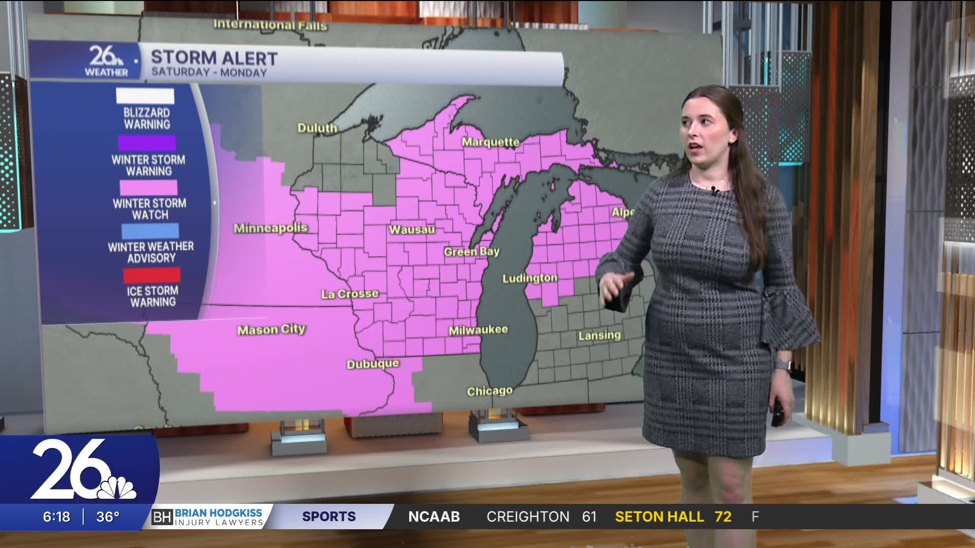
Then all attention turns to this weekend. The National Weather Service has already issued Winter Storm Watches. Saturday will start off nice, but late Saturday is when the snow begins. Snow will continue through all of Sunday and into Monday. When all is said and done, some areas could see 1–2 feet of snow, with locally higher amounts possible.
Right now, we are closely watching where the band of heavier snow will set up. It is possible that our more southern counties could see more sleet and an icy mix, which could cut into snow totals. Winds will also be very strong, creating another hazard. Blizzard conditions are possible Sunday and Monday, with heavy snowfall rates and strong winds causing whiteout conditions.
Travel will be dangerous this weekend.
After the winter storm, temperatures will turn much colder for a few days.
