

Thursday starts off nice, but that will be short-lived. We have winter weather advisories and winter storm warnings issued for the northern half of our area, and wind advisories issued for the southern half. Before the system arrives tonight, skies will be mostly sunny with highs in the low 40s.
Tonight, snow and a wintry mix move into northeast Wisconsin. The highest totals will be in our northern counties, with amounts decreasing as you go south. The highest totals up north could reach 6+ inches. To the south, a mix of rain and snow will fall with totals from a trace to 2 inches. As the system moves through, winds will pick up, with gusts near 40 miles per hour. Snow continues tomorrow morning before letting up Friday afternoon.
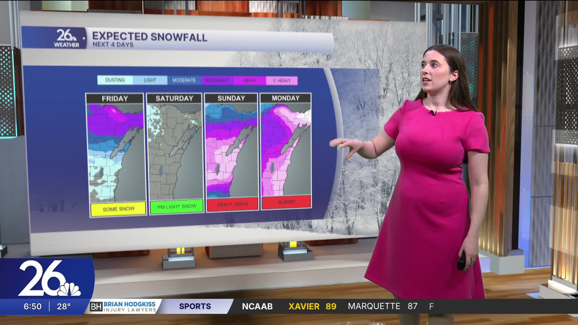
Saturday starts with a mix of sun and clouds. Snow begins late Saturday and continues into Sunday and Monday. The heaviest snowfall will be on Sunday. Significant snowfall is likely with this system, along with strong winds. We will have dangerous travel conditions over the weekend. It is very important to keep an eye on this forecast, as there could be very large snowfall totals. Over a foot of snow is possible.
