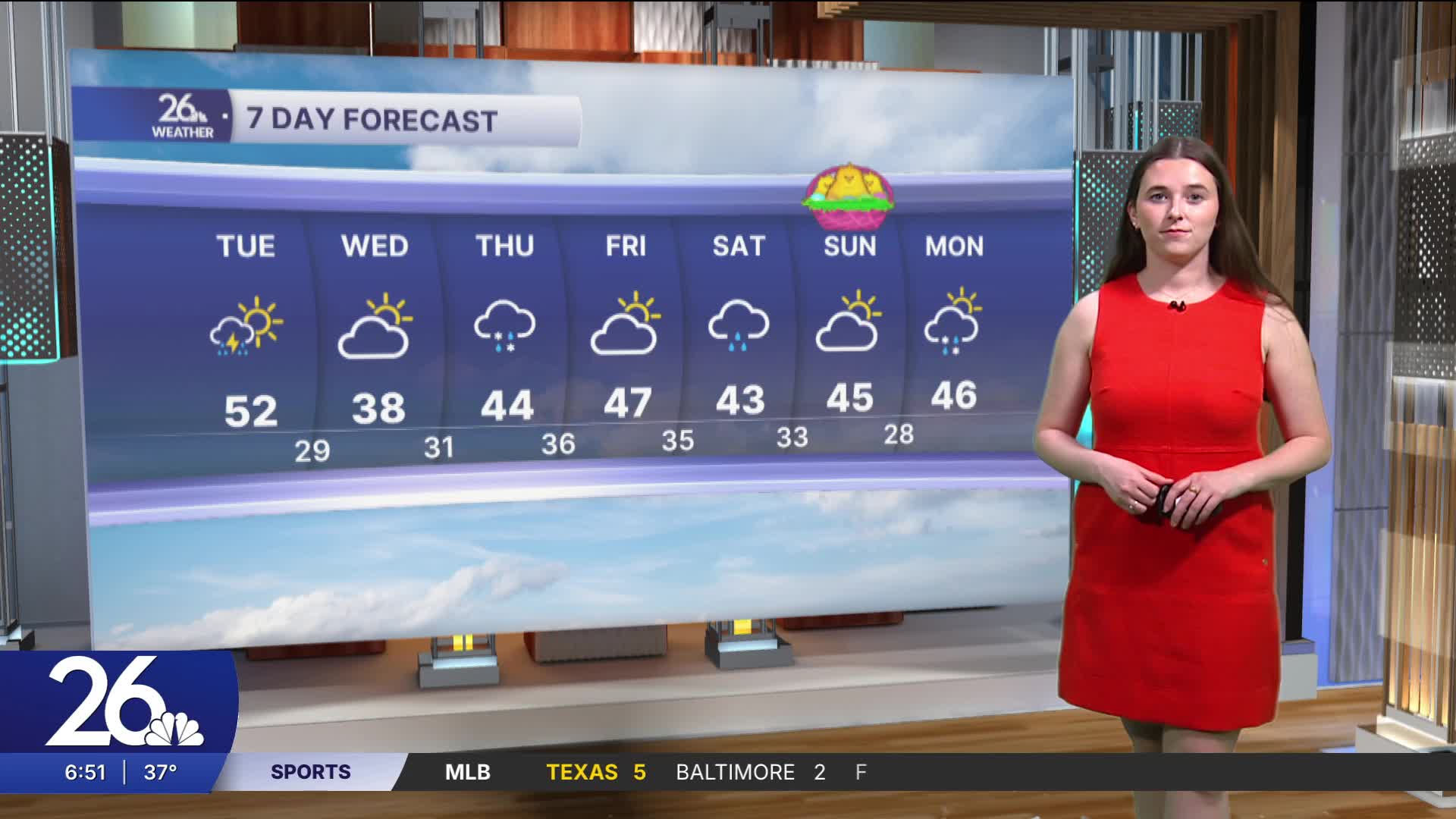


Last night, thunderstorms moved through, bringing rain and hail, and we have another chance for thunderstorms today. There is a Level 1 (marginal) risk for severe storms, with the main hazard being hail around one inch in diameter. Scattered showers will begin this morning and continue into the evening, with a few potentially becoming severe. High temperatures will reach the low 50s later this afternoon.
Tomorrow will be cloudy before a second system moves in Wednesday night into Thursday. It will begin as rain and freezing rain, with snow to the north, and by Thursday afternoon, everything is expected to transition to rain. The potential for significant icing is something to watch as we head into Wednesday night.
There is another chance for rain on Saturday. With all of this precipitation, river levels will likely rise.
