



Overnight skies were able to clear some, especially to the north, so this morning we are waking up to temperatures in the 40s across our northern counties. Clouds to the south helped keep a bit more warmth in our southern counties, where morning temperatures are in the mid-50s. By this afternoon, highs will be around 70 degrees. After the morning sun, we will see a mix of sun and clouds throughout the rest of Wednesday.
Overnight, cloud coverage increases, and there is a chance for a few isolated, light rain showers. Any lingering rain should wrap up by Thursday morning. Thursday starts fairly cloudy, but some afternoon sun will begin to mix in. Highs tomorrow will be in the low to mid-70s.
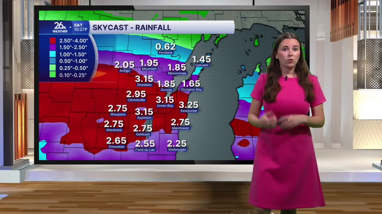
Clouds increase again overnight Thursday, and by Friday, we wake up to cloudy skies ahead of our next chance for rain. Rain will begin early Friday afternoon and continue overnight and throughout much of Saturday. While there may be some thunderstorms within this system, there is no concern for severe weather. The main concern is the risk for heavy rainfall and flooding. Rain Friday and Saturday will be widespread and heavy at times, making it likely that many places will see at least 1 inch of rain, with 2-3 inches possible in some areas. This may lead to localized flooding in urban areas and small streams.
Rain mostly wraps up by Saturday night, but we will continue to see some chances for showers as we head into next week.
After seasonable temperatures over the next two days, we will begin to feel more like fall for the rest of the week. Highs will be in the mid-60s as we approach the start of fall next Tuesday.
