

We are starting Tuesday with areas of dense fog along the lake, as well as scattered rain showers across the region. As we head into the afternoon, some clearing is expected. High temperatures will reach the 80s today, and with dew points remaining high, it will feel quite muggy.
Heat and humidity increase on Wednesday, with dew points staying elevated. Hot and humid conditions are expected to continue through Thursday.
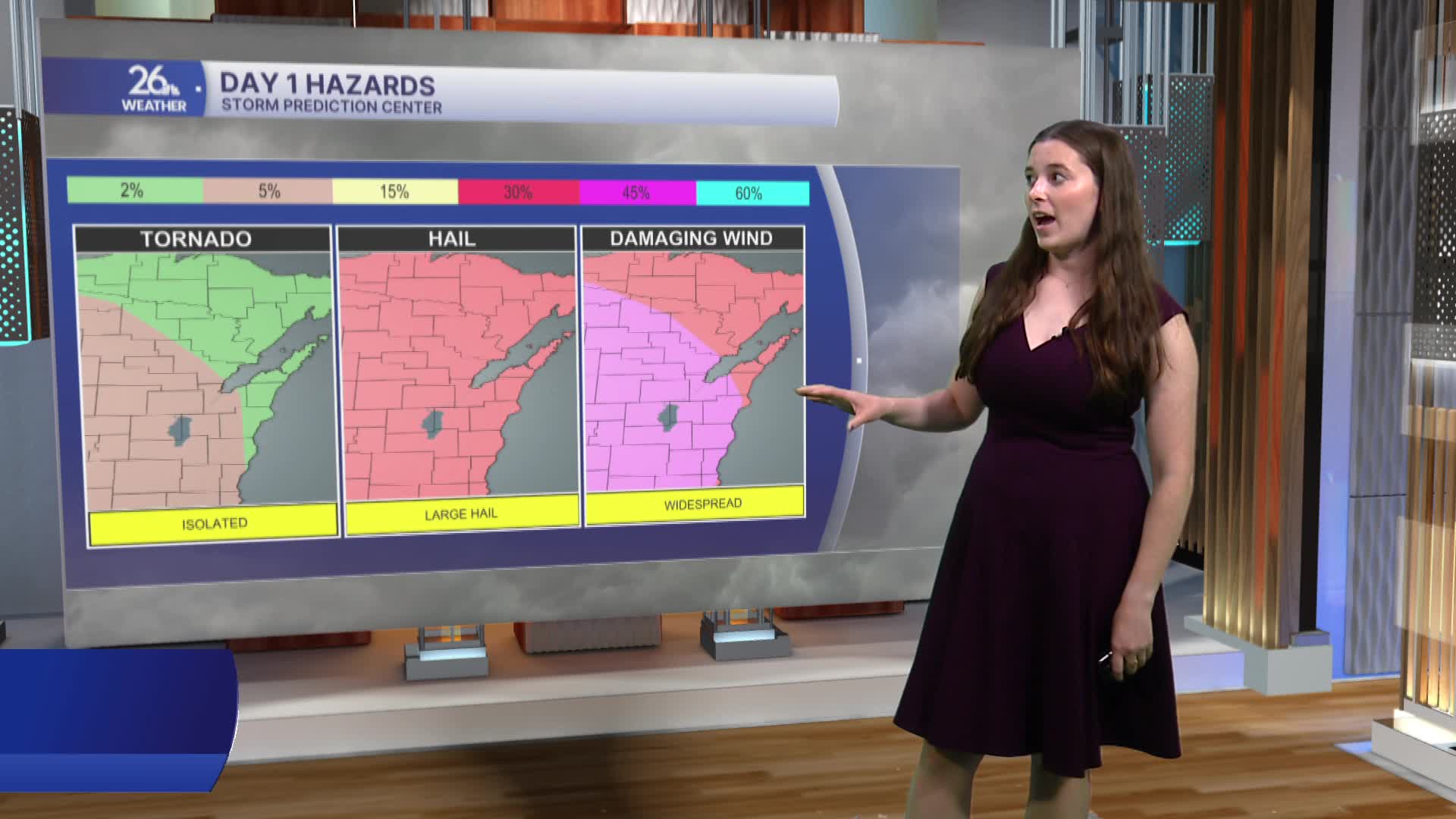
Wednesday morning will bring scattered showers and thunderstorms, but severe weather is not anticipated at that time. However, the risk for severe weather increases Wednesday evening. Most of the area is under a Level 3 severe weather risk, with damaging winds, large hail, and isolated tornadoes all possible.
After a brief break Thursday morning, another round of severe thunderstorms may develop Thursday afternoon and evening.
Conditions quiet down heading into the weekend, with temperatures cooling back into the 70s.
