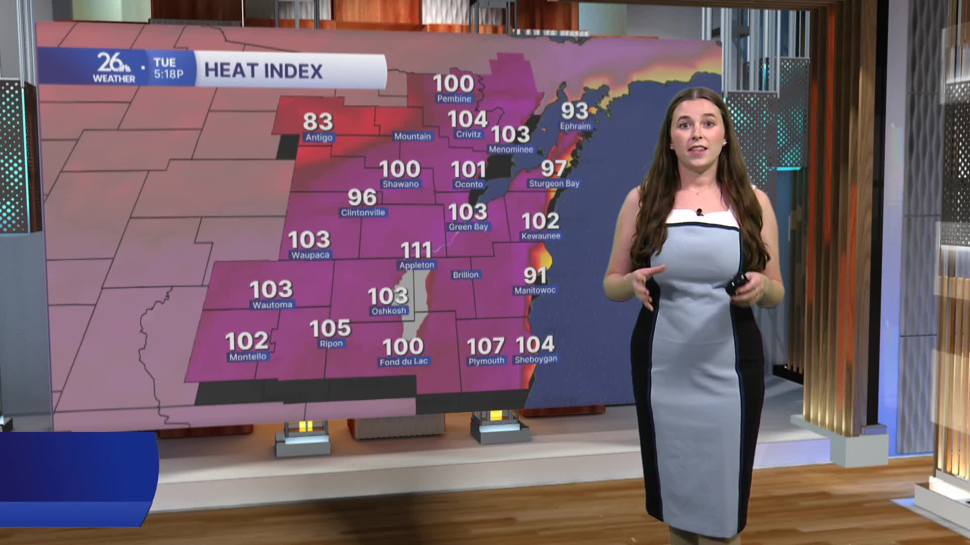


Much of Northeast Wisconsin remains under a Severe Thunderstorm Watch until 10 p.m. Tuesday. The combination of intense heat and high humidity has created an atmosphere capable of producing strong to severe thunderstorms through the evening.
Over the next several hours, thunderstorms are expected to develop and could bring damaging wind gusts, large hail, frequent lightning, and torrential downpours that may lead to localized flooding. Storm chances decrease throughout the night
The threat continues into Wednesday. A round of storms is expected Wednesday morning, followed by a brief lull before additional thunderstorms develop Wednesday afternoon and continue into Wednesday night. Some of these storms could become severe, with all hazards possible, including damaging winds, large hail, heavy rainfall, and isolated tornadoes.
Another round of strong to severe thunderstorms is also possible on Thursday.
While the Extreme Heat Warning has expired, the hot and humid pattern is far from over. High temperatures will climb into the upper 80s and lower 90s through the rest of the workweek, although cloud cover and thunderstorms may keep some locations a bit cooler. Dew points will remain elevated, making it feel much hotter and keeping uncomfortable humidity in place through the week.
