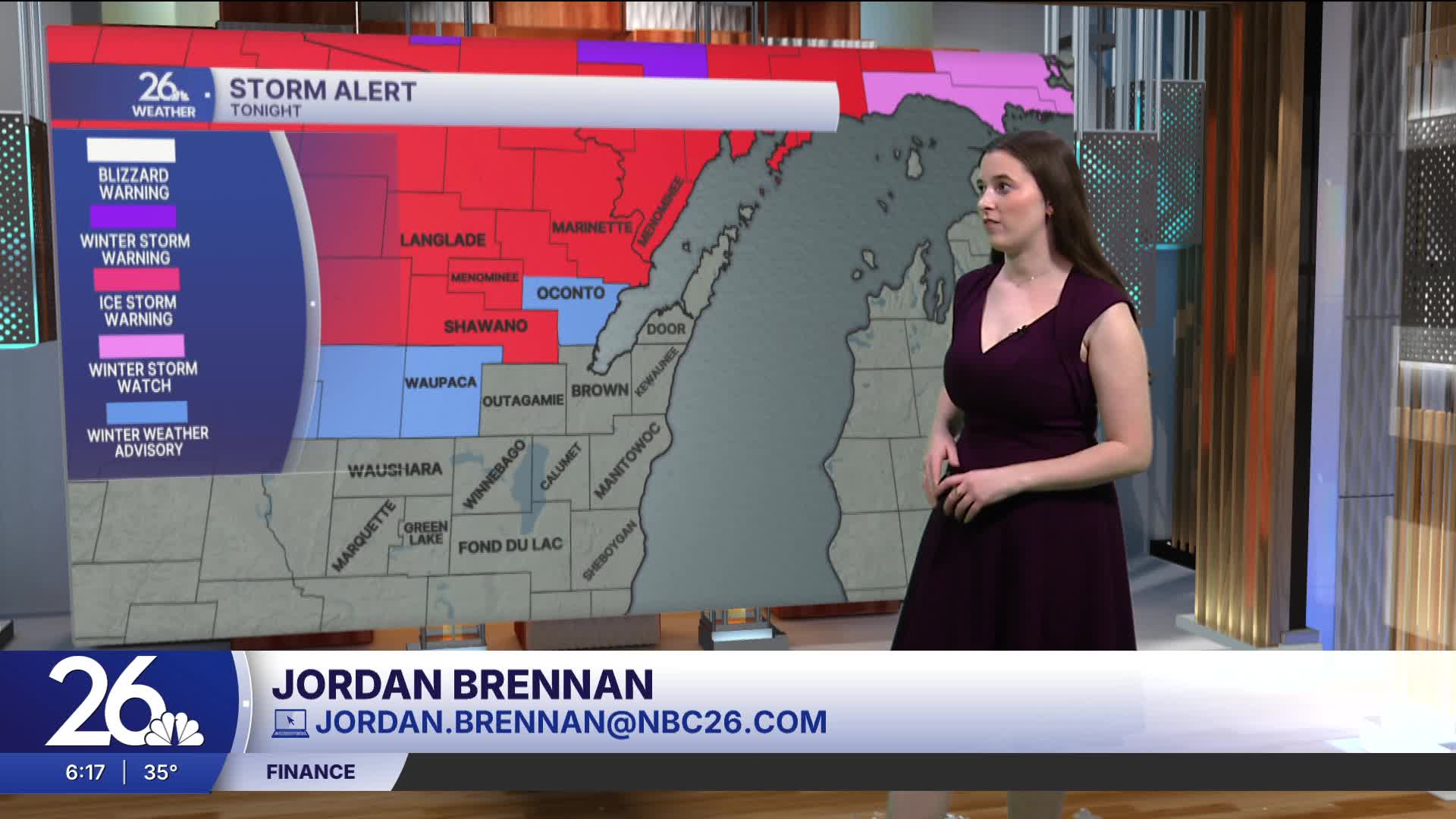


Most of Friday will be quiet, with cloudy skies and a breeze. Highs today will reach the mid-40s. Tonight, a second round of weather will move through, bringing rain for most areas but freezing rain to the north. Ice storm warnings have been issued for our northern counties, where ice accumulation could range between 0.25–0.50 inches. There is a high chance for tree damage and power outages in areas with significant ice buildup. Make preparations in case you do lose power. In areas where rain falls, non-severe thunderstorms are possible.
Showers will linger into Saturday morning, and it will remain cloudy afterward. Both Saturday and Sunday will see highs in the mid-40s along with breezy conditions. Easter Sunday will feature a mix of clouds.
We have another chance for rain or a wintry mix on Monday, with additional rain expected Wednesday and Thursday. With all this precipitation, it is important to keep an eye on rivers, as rising water levels are expected.
