

Yesterday was a cold one, cold enough to break the record for the lowest high temperature recorded. This came after a morning that brought negative temperatures for most areas, with even chillier wind chills. So far, December has been off to a well-below-average start, and it seems it will be staying that way for a while.
This morning, temperatures are in the mid-teens, but wind gusts up to 20 miles per hour are dropping wind chills into the single digits for many. Once again, be sure to grab your layers when you head out the door. The day will start off cloudy, and early this afternoon light snow will begin to develop. Totals of around an inch or less are expected. We’ll see another chance for light snow Saturday night. Amounts will remain low, but there may still be travel impacts, so use caution on the roads.
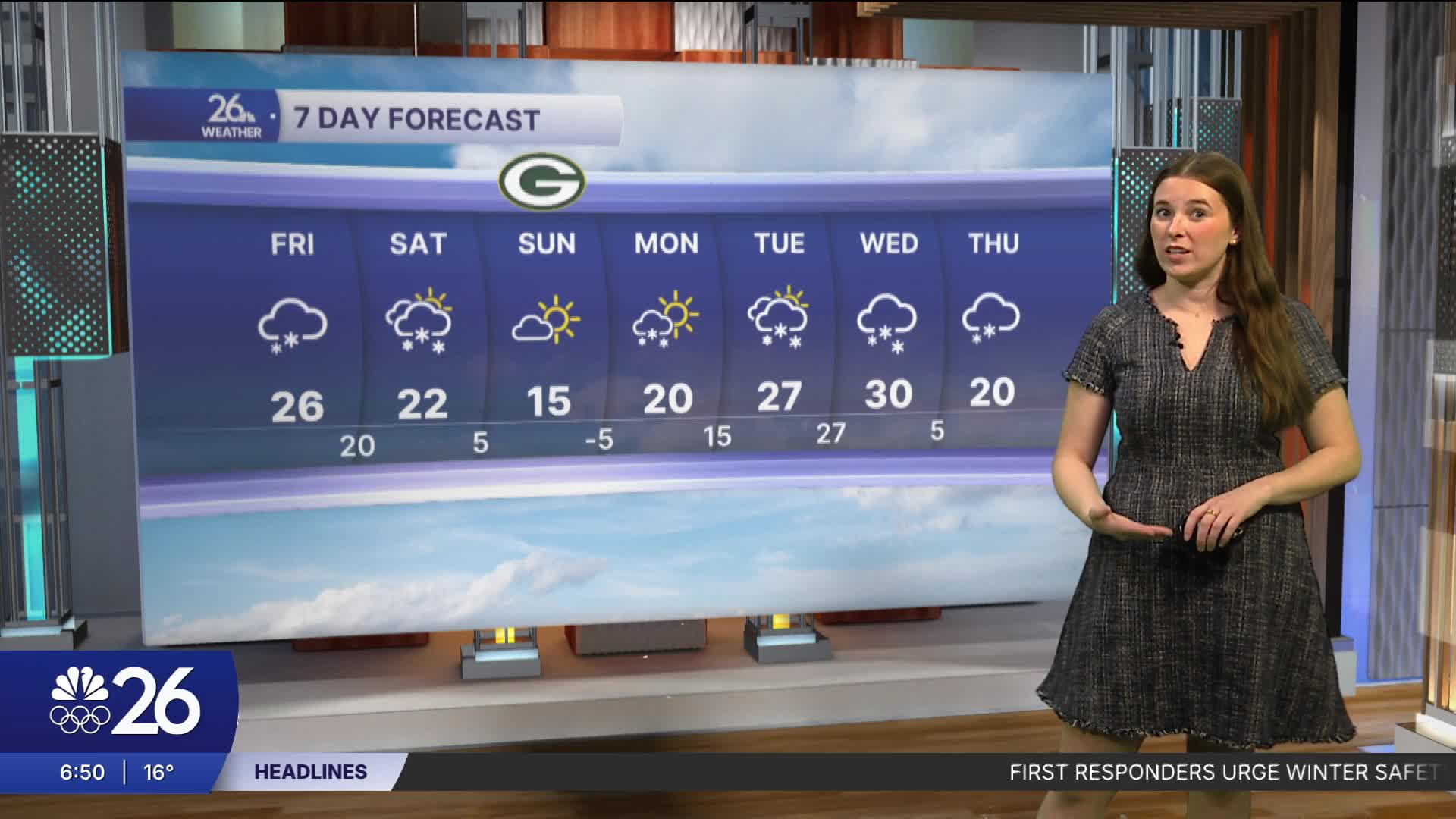
The Packers game will be a cold one. High temperatures that day will be in the upper teens, with wind chills in the single digits, so have your warm clothes ready if you’re heading to the game.
Over the next week, we continue to see below-average temperatures and systems bringing light snow.
