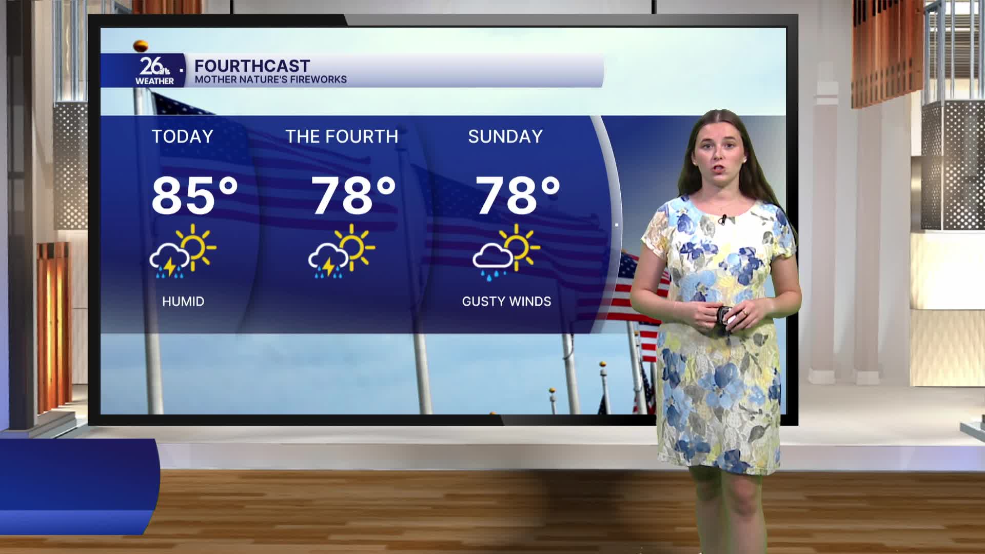


As we head into the holiday weekend, our weather is finally trending in a more comfortable direction. Today will remain warm and humid, with afternoon highs climbing into the mid-80s. By the weekend, however, temperatures will ease back into the upper 70s to around 80 degrees, and lower dew points will make it feel much more pleasant. Even with the cooler, less humid air, it's still important to stay hydrated and be careful if you'll be spending extended periods outdoors. Warmer temperatures return next week, but humidity levels are expected to remain much more manageable.
We'll see a mix of sun and clouds today, with our next chance for rain arriving this afternoon. Scattered showers and thunderstorms are expected to develop, and a few storms could become strong. Saturday will also feature a mix of sun and clouds, along with the chance for a few afternoon showers and thunderstorms. If you have Fourth of July plans, be sure to keep an eye on the forecast, although severe weather is not expected. A few scattered showers may linger into Sunday morning before drier weather returns for the start of the new workweek.
