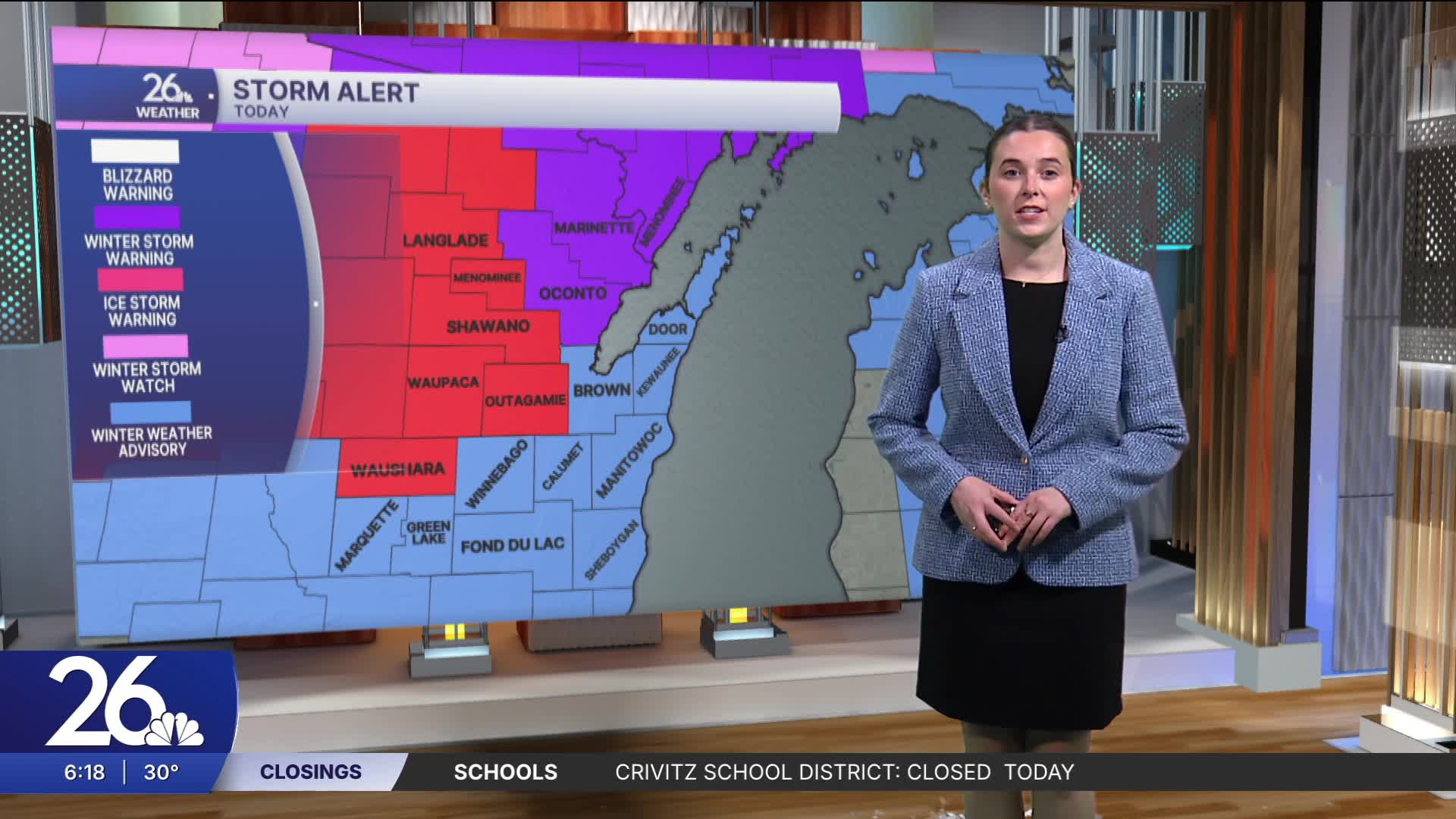


There are ice storm warnings, winter storm warnings, and winter weather advisories in effect across northeast Wisconsin this morning. Freezing rain and sleet are falling and will continue into the morning. Areas under warnings could see between 0.25–0.50” of ice accumulation, while other areas may see 0.10–0.25”. Slick roads will be an issue early today, with tree damage and power outages possible, especially in areas with higher ice accumulation.
Warmer air will push in, and we will begin to see a transition to rain by mid-morning, occurring from south to north. Freezing rain will continue in far northern areas for much of the day. Along with this rain, there is also a chance for thunderstorms, a few of which could be severe. There is a risk of hail, gusty winds, and heavy downpours.
Most of Friday will feature a mix of sun and clouds; however, a second system will move through Friday night. This system will bring rain and some thunderstorms for most areas, with more freezing rain to the north. A winter storm watch has been issued for far northern areas.
