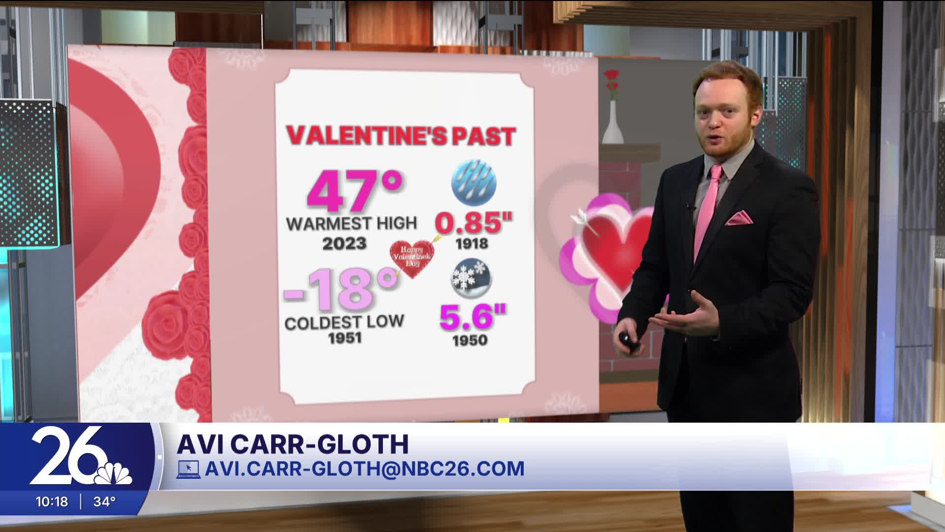
High temperatures in northeast Wisconsin matched the Valentine's Day record high in the upper 40s.
After some late night patchy fog, Sunday will warm up into the upper 40s/low 50s with mostly sunny skies.
Monday is shaping up to be even warmer reaching the low/mid 50s.
Later next week, a big drop closer to normal is expected for our highs along with rain/snow mix and possibly accumulating snow.
Avi's forecast

Posted
