

As we begin the work week, summer-like conditions will settle into the region. This week will bring increasing heat, humidity, and the potential for thunderstorms.
Temperatures will gradually warm through midweek. Highs this afternoon will reach the upper 70s to around 80 degrees. Tuesday becomes warmer, with temperatures climbing into the mid-80s. The heat peaks on Wednesday, when highs are expected to reach around 90 degrees with dew points in the 70s. The combination of heat and humidity will make conditions feel especially uncomfortable. Warm and humid weather continues into Thursday before some relief arrives by the weekend.
Weather conditions will also become more active this week. Scattered showers and a few thunderstorms are possible today, especially during the afternoon and evening hours. A few showers could linger into Tuesday morning before skies begin to clear.
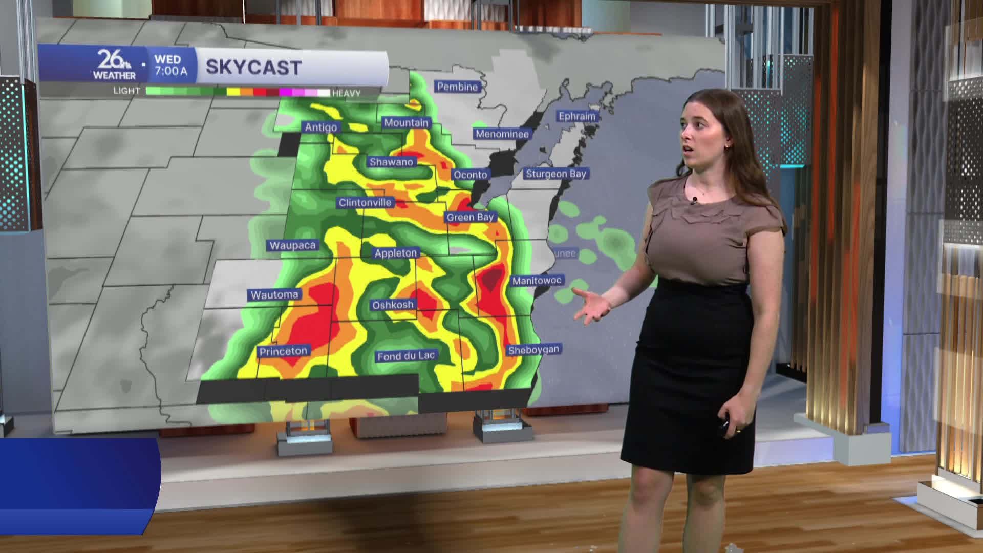
Wednesday will be the day to watch closely. All of Northeast Wisconsin is currently under either a level 2 (slight) or Level 3 (enhanced) risk for severe thunderstorms Wednesday evening. Multiple rounds of severe weather may develop, with damaging winds, large hail, and tornadoes all possible. Thursday could also bring another chance for severe thunderstorms.
