

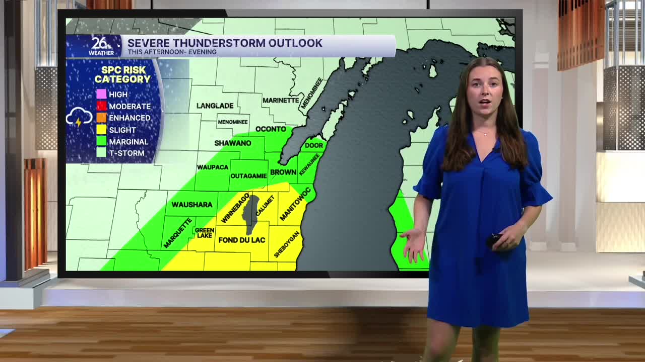


We are getting two rounds of much-needed rain today, with the potential for a few strong to severe storms this afternoon and evening.
Showers are moving across the area this morning. A few rumbles of thunder are possible, but severe weather is not expected during the morning round. Rain should move out by late morning, giving us a brief break and allowing things to dry out into the early afternoon.
By mid-afternoon, showers and thunderstorms will begin to redevelop. This is when our severe weather threat increases. There is a Level 2/5 risk for severe weather across parts of northeast Wisconsin, with a Level 1/5 risk across surrounding areas. Storms will move through during the afternoon and evening, and a few could become strong to severe. Damaging winds, large hail and heavy downpours are the primary threats. An isolated tornado cannot be ruled out.
High temperatures will climb into the upper 70s this afternoon, with increasing humidity making it feel warmer.
The weather improves this weekend. Saturday will be mostly sunny, although a few isolated afternoon showers are possible. Humidity will begin to drop, making for more comfortable conditions.
Sunday looks even better, with mostly dry weather and comfortable temperatures. Highs both days will range from the mid-70s to upper 70s.
Our next chance for rain arrives Tuesday night.
