
There were numerous reports of flooding across the area on Wednesday as we had severe weather move through the state. NO tornadoes were reported in Northeast Wisconsin, but funnel clouds were seen in FDL & MQT counties.
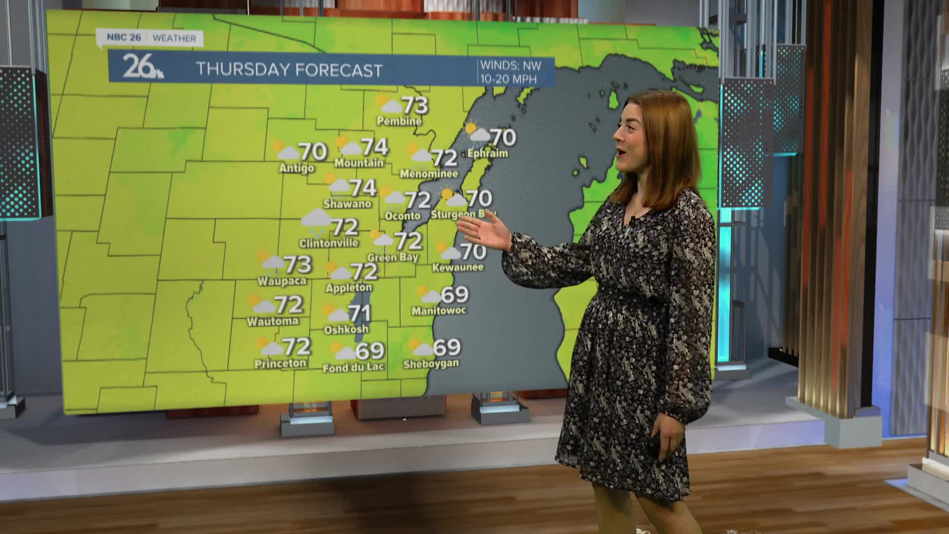
A cold front moved through yesterday evening bringing cooler conditions to our neighborhoods. Highs will be in the low 70s today. This is 10 degrees below average. These are the coldest highs we have seen so far this month.
We remain in the 70s for Friday and Saturday. Sunny skies are expected for Friday before another chance for thunder on Saturday morning. Severe weather is not expected.
Sunday we will make it into the low 80s. There are more 80s and more storm chances as we look towards next week.
