

Flooding will continue to be a concern over the next few days. There are multiple flood alerts across northeast Wisconsin after last night’s rain further raised water levels. This has been the second-wettest April on record so far, and we are seeing the impacts in our waterways. Additional chances for rain will sustain these flood risks throughout the week.
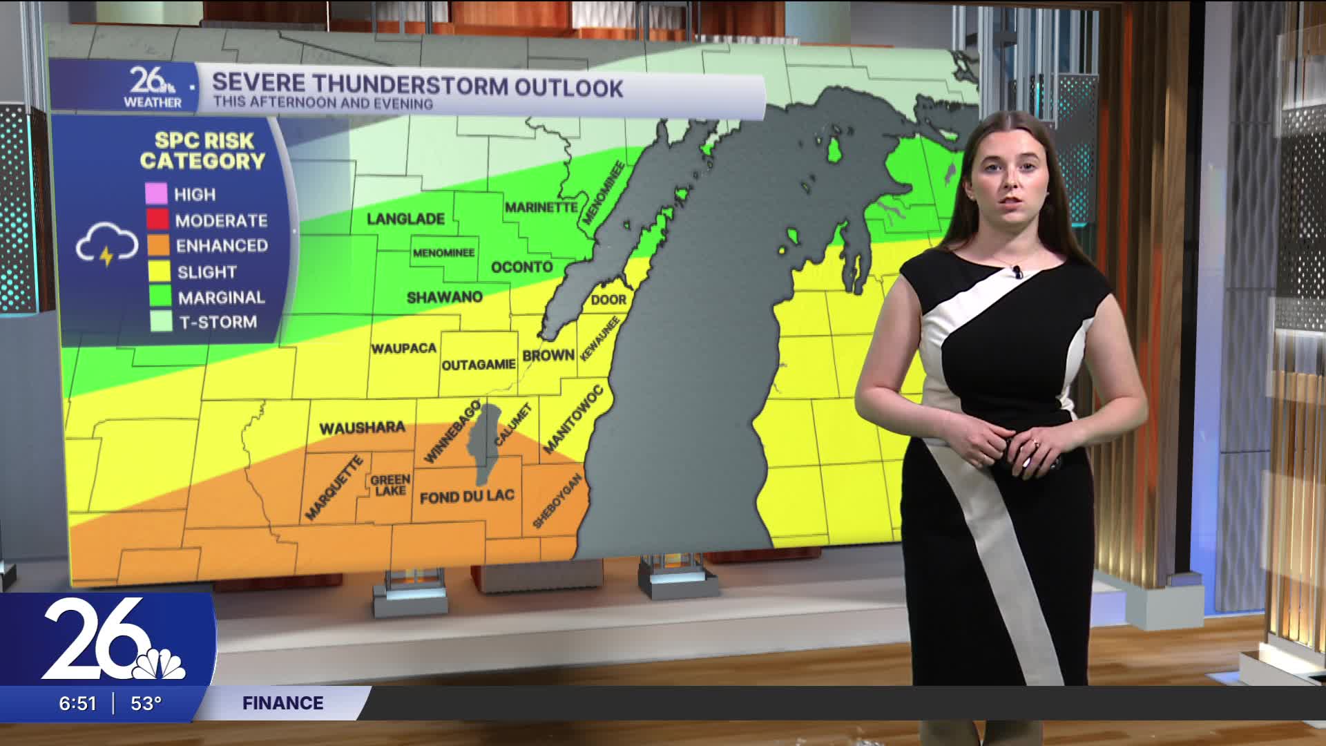
Rain will begin this afternoon, with thunderstorms developing as we head into the evening. A few of these storms could become severe, with risks including hail and damaging winds, and tornadoes cannot be ruled out.
There is another chance for thunderstorms tomorrow, although only the southern half of the viewing area is at risk for severe weather.
Rain chances continue into the weekend as temperatures remain above average, before becoming more seasonable later in the weekend.
