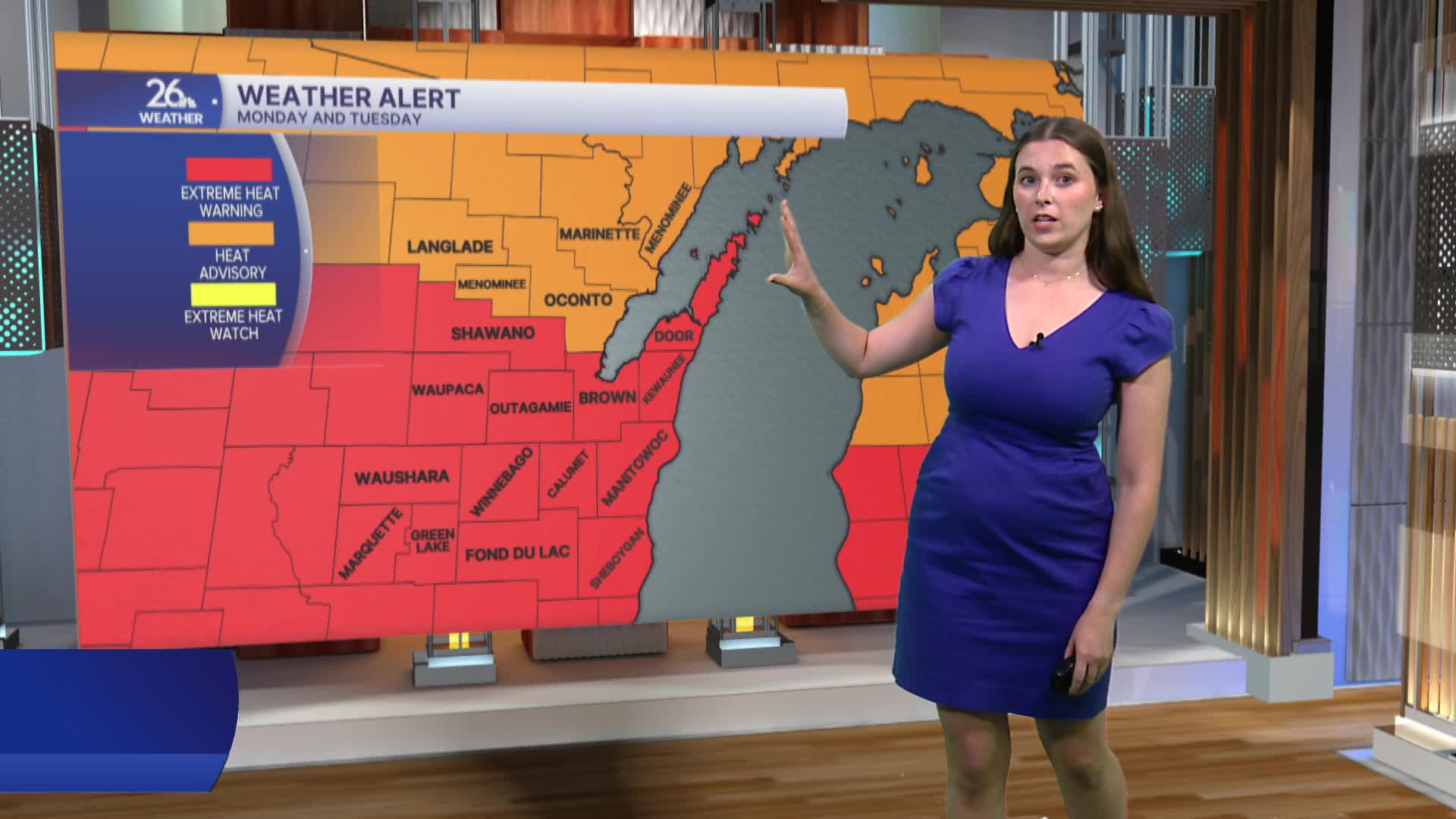


High temperatures climbed into the 90s today, and with dew points in the 70s, it felt more like 100 to 105 degrees across much of northeast Wisconsin. Extreme Heat Warnings remain in effect for most of the area, while our northern counties are under Heat Advisories. Both alerts continue into Tuesday as dangerous heat and humidity persist.
Tuesday will bring another day of hot conditions, with afternoon highs returning to the 90s. Combined with high humidity, heat index values, or "feels like" temperatures, will once again soar into the triple digits. The hot, muggy pattern is expected to continue through much of the workweek.
With several days of dangerous heat ahead, it's important to take precautions. Limit strenuous outdoor activities during the hottest part of the day, stay hydrated by drinking plenty of water, and check on neighbors who may be more vulnerable to the heat. Never leave children or pets unattended in a vehicle, even for a short time. Pet owners should also be mindful of hot pavement, which can quickly become hot enough to burn paws.
The heat and humidity will also fuel daily chances for thunderstorms. On Tuesday, our northern counties are under a Level 2 of 5 risk for severe weather, while the rest of northeast Wisconsin is in a Level 1 of 5 risk. The primary threats include damaging wind gusts, small hail, and heavy rainfall.
Another round of thunderstorms is possible Wednesday, when a Level 1 of 5 severe weather risk is in place. The main hazards will be damaging winds, large hail, and locally heavy downpours. Additional rounds of showers and thunderstorms remain possible through the rest of the week.
