Yesterday gave us a cold welcome to December, and we’re going to continue with that trend through the first week of the month. Temperatures this morning were milder than yesterday because of overnight cloud cover. These clouds brought some light snow that ended overnight and left small accumulation across the area. As you head out this morning, be careful of any slick spots.
Today will feature a mix of sun and clouds with high temperatures in the low 20s, about 10 to 15 degrees below average. Clouds will thicken overnight and bring our next chance for snow. Light snow will begin late tonight and continue through the first half of Wednesday. Accumulation will be light, many areas will see half an inch or less, but it will still be enough to cause some travel impacts, so continue to use caution on the roads.
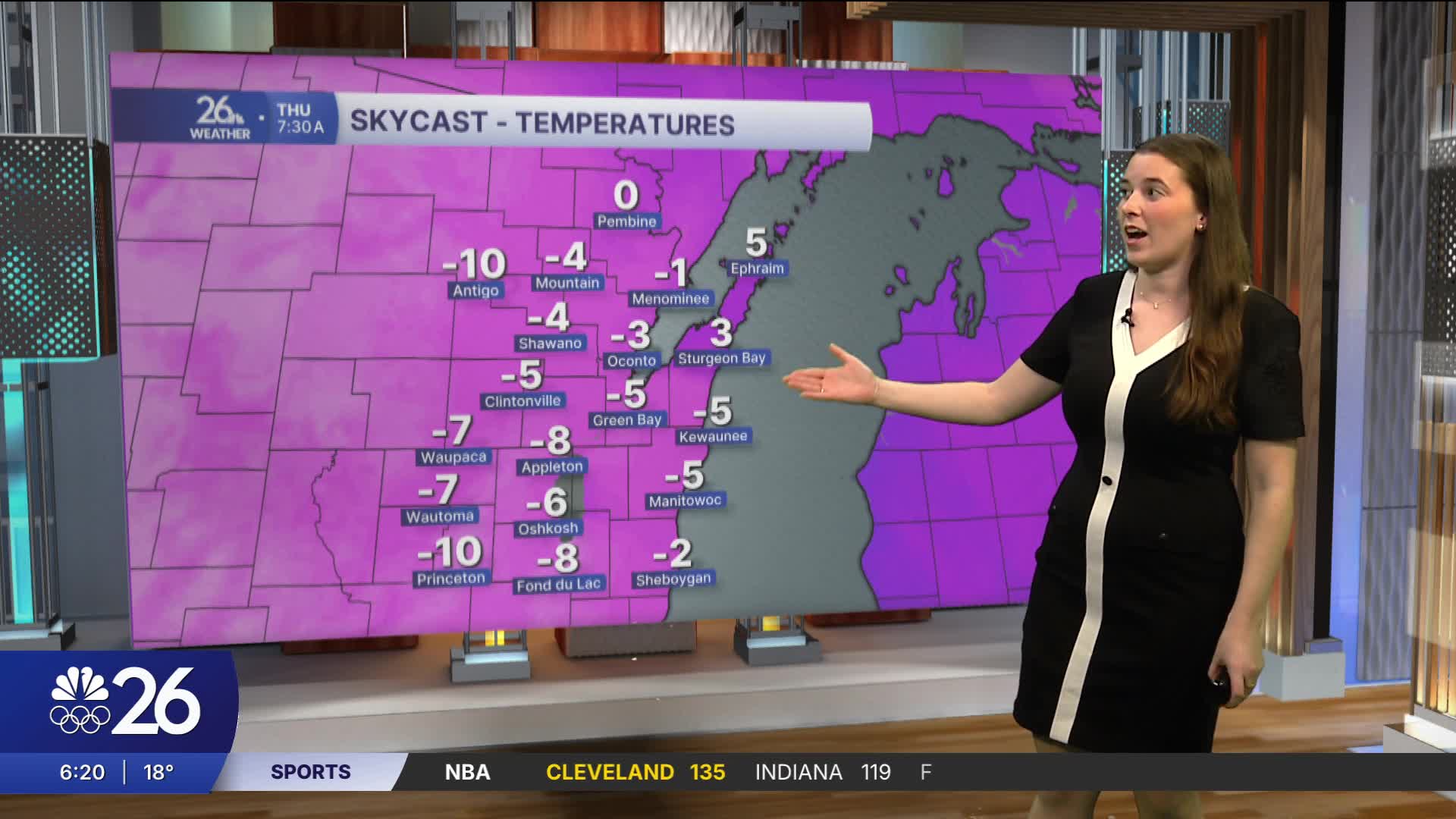
This snow comes ahead of an arctic front that will bring much colder air into the region. Temperatures will warm slightly on Wednesday before quickly dropping throughout the afternoon. Wind gusts, at times near 20 miles per hour, will make it feel even colder. By Thursday morning, temperatures will be close to or below zero for most, with wind chills dipping into the negative teens. Make sure to take precautions and prepare for the cold.
Jordan's forecast


Posted
