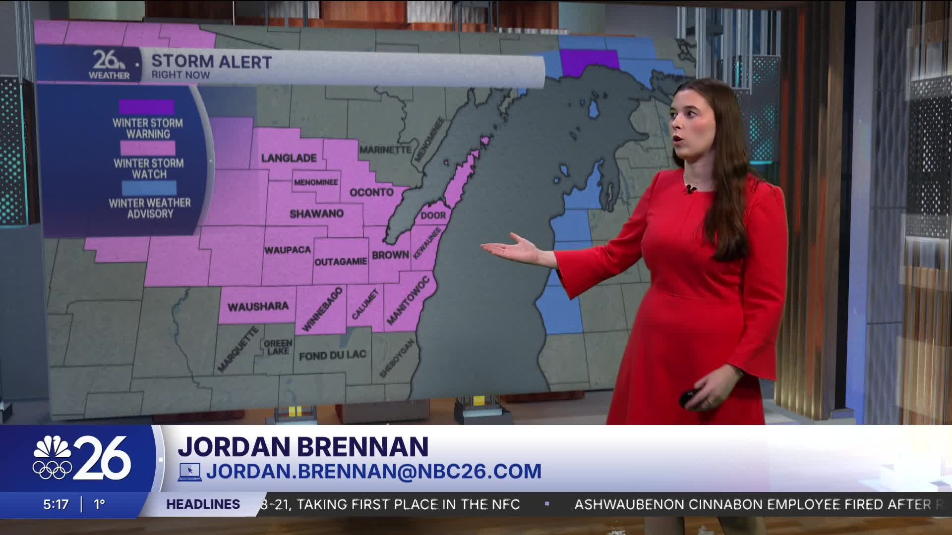


Most of our counties are under a Winter Storm Watch for snow that will impact the area Tuesday into Wednesday.
We’re kicking off the work week on a cold note, with many starting Monday in the low single digits or even below zero. Highs this afternoon will reach the low 20s. Clouds will increase through the morning, and a few flurries are possible this afternoon. Tonight, a system moves through, bringing 1 to 2 inches of snow to much of the area.
A second system arrives shortly after, bringing more significant snowfall Tuesday into Wednesday. Snow will begin Tuesday afternoon and continue into very early Wednesday, with the potential for heavier snowfall during the Tuesday evening commute. Most of the area will see 3 to 6 inches, but we need to continue to watch this to determine where the strongest bands will set up to bring the highest totals.
Temperatures Tuesday and Wednesday will be relatively warm compared to recent days, with highs near 30 degrees. After the second system moves out, temperatures drop again, and an arctic cold front arrives Friday, bringing light snow followed by much colder temperatures for the weekend.
