

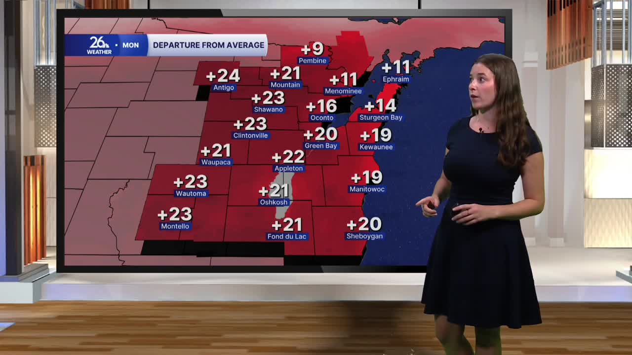


This weekend felt more like summer than October, and the unseasonably warm weather isn’t over just yet. Green Bay set a new record high on Saturday, reaching 83 degrees, and temperatures climbed back near 80 on Sunday.
We have one more day of summer-like warmth today, with highs once again climbing into the low 80s. A southwest breeze will help temperatures soar well above average, and we could make another run at the record high in Green Bay. The record for today is 82 degrees, so there’s a chance we tie or even break it.
Skies will start off mostly cloudy, but we’ll see more sunshine break through this afternoon. A few scattered showers are expected this evening, mainly across our northern counties, and an isolated rumble of thunder can’t be ruled out. Clouds will linger overnight, keeping temperatures unusually mild, with lows holding in the 60s.
Rain should move out by Tuesday morning, ushering in a return to more seasonable fall weather. Highs Tuesday will settle into the upper 60s under a mix of sun and clouds. Cooler air arrives by Wednesday, bringing temperatures down into the low 60s.
Another system could bring more rain on Thursday, followed by an even cooler and windier pattern. By Friday and into the start of next weekend, highs will struggle to reach the upper 50s, while overnight lows dip toward the freezing mark. Friday will also turn breezy to windy, adding to the chill.
