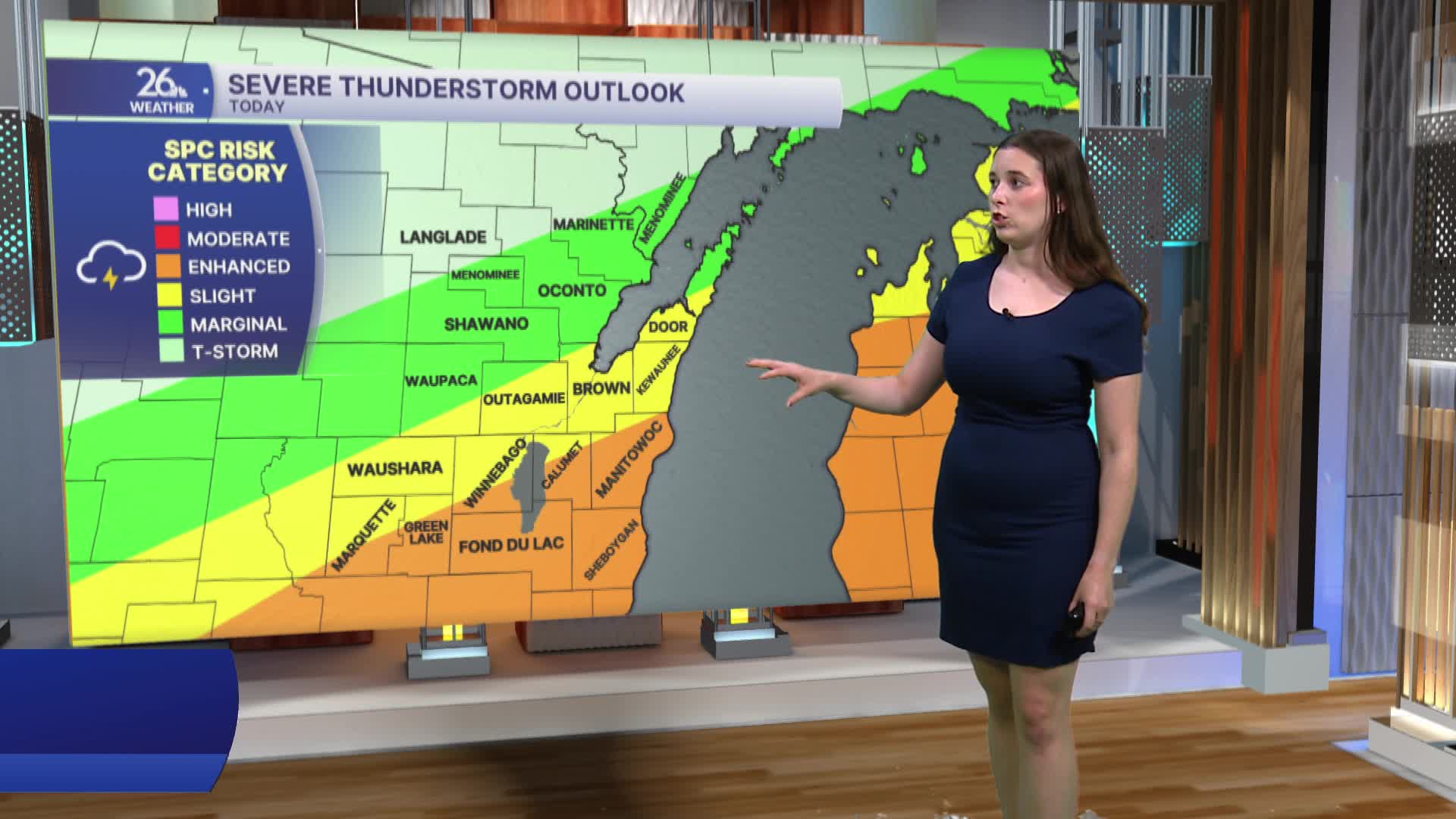


After severe thunderstorms produced multiple reports of wind damage, another round of severe weather is possible today. Thursday will begin with some sunshine, but clouds will increase through the afternoon. Showers and thunderstorms are expected to move through late this afternoon and into the evening.
Some storms could become severe, with all hazards possible, including damaging winds, large hail, and isolated tornadoes. The greatest risk for severe weather is across our southern counties.
Thursday will remain warm and humid, but conditions will become more comfortable as we head into the weekend and next week. Humidity levels will drop, and temperatures will cool, with highs generally staying in the 70s through much of next week.
Saturday brings a chance for a few afternoon thunderstorms, but overall, weather conditions are expected to quiet down after today's storms.
