



After some light morning showers pass, clouds will linger through much of the morning. By this afternoon, sunshine will begin to break through the clouds. High temperatures will be seasonable, reaching the upper 60s and lower 70s.
Tonight, there will be a brief period of clearing before clouds build back in. Overnight lows will fall into the mid-50s, with some patchy fog potentially developing by Friday morning.
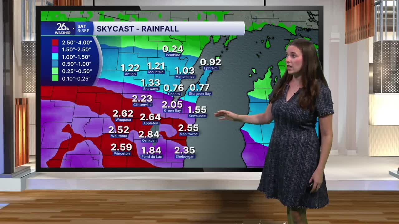
Friday will start mostly cloudy before rain moves in during the afternoon. The rain will continue overnight and through much of Saturday, with periods of heavy rainfall possible, particularly from Friday night into Saturday morning. There could also be a few rumbles of thunder, but severe weather is not expected with this system.
The primary concern will be the potential for heavy rainfall and localized flooding, especially on roads and in urban areas. Some small streams could also experience elevated water levels. Overall, 1 to 3 inches of rain is expected across northeast Wisconsin. Rain will gradually taper off throughout the day Saturday.
Skies will remain mostly cloudy Sunday, but the weather should stay dry. Light shower chances return Monday and Tuesday before drier weather settles in for the middle of next week.
This weekend will be breezy at times, with temperatures cooling into the mid-60s. Cooler, fall-like weather will continue into next week.
