

Weather today will be nice, but that is not the story for the rest of the week. Skies will be a mix of sun and clouds, with temperatures ranging from the 50s to nearly 70 across northeast Wisconsin.
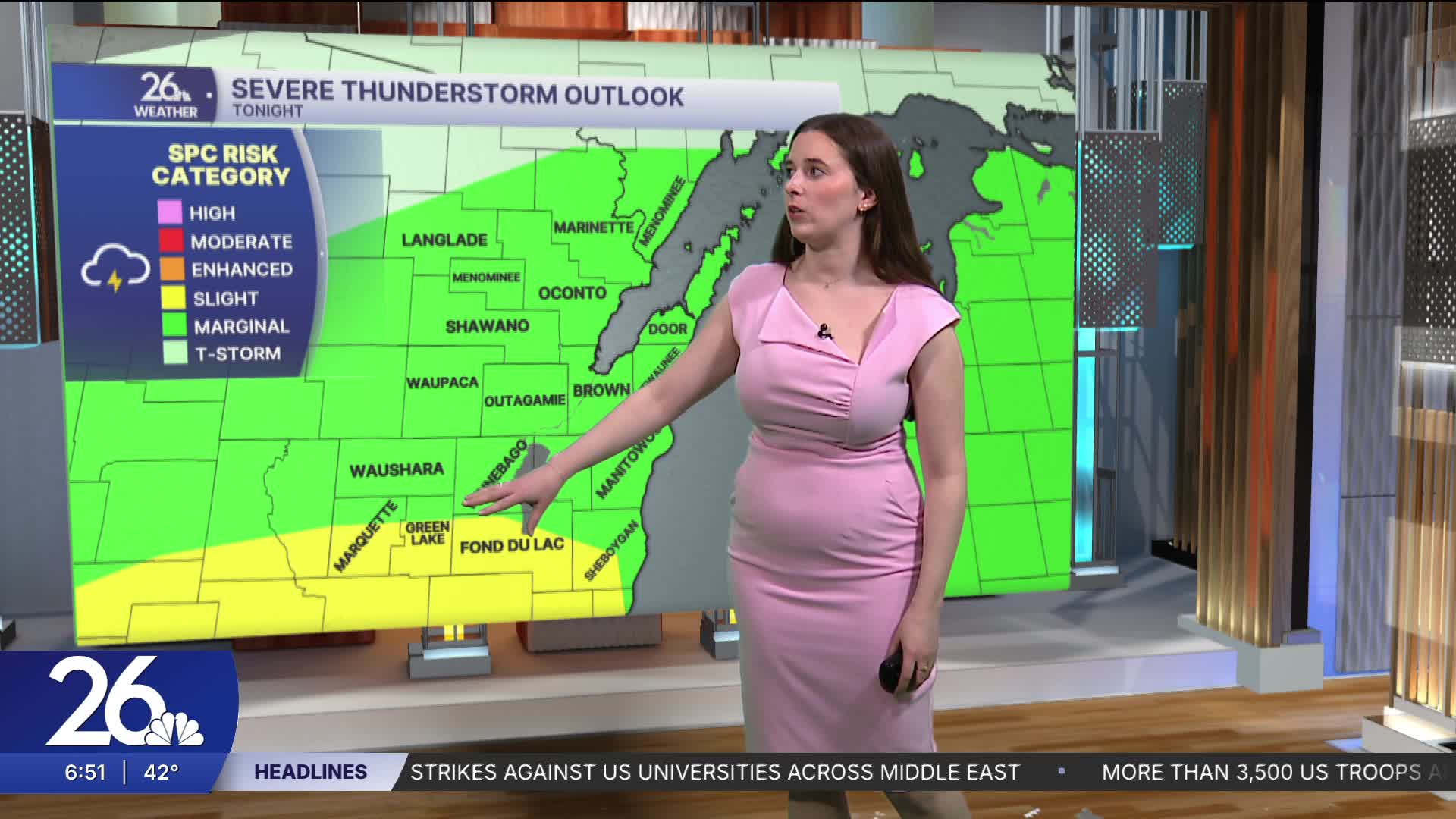
Tonight is when more active weather begins. There is a chance for some isolated thunderstorms, a few of which may be severe. Heavy rain, gusty winds, and some hail are possible. A second round of thunderstorms may develop Tuesday afternoon. There is a Level 1 risk across most of the area on both Monday and Tuesday.
Wednesday night into Thursday will bring winter weather. A mix of snow, rain, and ice will fall throughout the night and into the day, likely causing impacts on the roads.
More rain is expected this weekend.
