

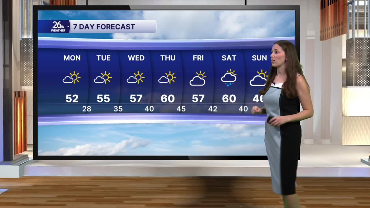


High pressure is in control of our weather this week, setting us up for a beautiful stretch of mid-November weather. This high pressure will keep conditions quiet while allowing temperatures to climb well above average.
Skies today will be mostly sunny with a few passing clouds. A light breeze will develop out of the southwest, with winds potentially becoming a bit breezier this afternoon. Highs will reach the low 50s, about 10 degrees above average.
The warming trend continues throughout the week, with highs climbing into the mid 50s on Tuesday and the upper 50s on Wednesday. Both days will feature plenty of sunshine, although it will remain breezy.
Thursday looks to be the warmest day of the week, with many locations potentially reaching 60 degrees. That's nearly 20 degrees above average for mid-November! We'll see a few more clouds, but sunshine will still be plentiful. There is also a low chance for a few light showers. Winds will be stronger, with gusts approaching 30 mph.
Friday brings a brief return to the 50s, along with a mix of sun and clouds. Temperatures rebound to near 60 degrees on Saturday, but clouds will increase and rain chances will be higher as scattered showers move through throughout the day. Winds will also pick up again.
Behind Saturday's system, cooler air moves back in, bringing temperatures down into the 40s.
