

It was another beautiful summer day across the area! The normal high for this time of year is 74 degrees, but most locations climbed 8 to 10 degrees above that mark.
Along with the warmth came plenty of sunshine, making for another picture-perfect afternoon.
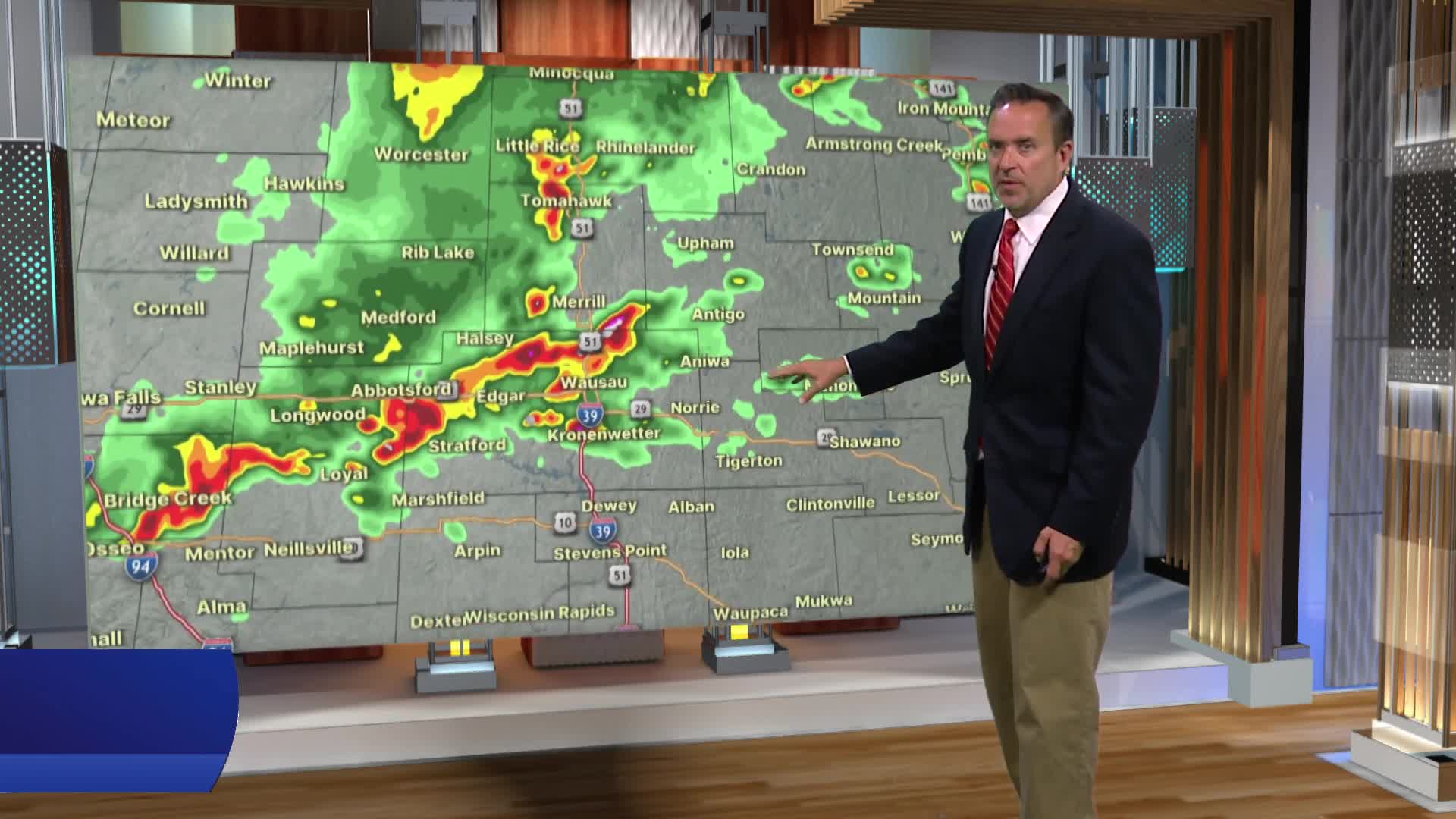
Our next weather maker arrives tonight, bringing the chance for showers and thunderstorms. Any storms that move through could produce locally heavy rainfall. Believe it or not, we actually need some rain. After experiencing the wettest spring on record, drought conditions have now developed across parts of the area.
Lots of sunshine is on the way for the first weekend of June!
An even bigger taste of summer arrives later next week, with highs soaring into the upper 80s and lower 90s. Dew points will also climb into the 70s, making it feel quite hot and humid.
