



It was a very warm to hot and humid day across northeast Wisconsin, with high temperatures ranging from the mid-80s to the lower 90s. Dew points hovered around 70 degrees, pushing heat index values above 90 degrees across nearly the entire area.
From Green Bay south, we saw a mixture of sun and clouds. North of Green Bay, however, numerous showers and thunderstorms developed throughout the afternoon and early evening, producing frequent cloud-to-ground lightning and torrential downpours. Doppler radar estimated that more than 5 inches of rain fell in parts of northern Oconto County.
Expect quiet weather overnight, although areas of fog may develop where heavy rain fell earlier today.
Friday morning will begin with a mixture of sun and clouds, but clouds will thicken as additional showers and thunderstorms overspread most of the area during the afternoon and evening. Before the rain arrives, temperatures will climb into the lower to mid-80s.
On Saturday, morning showers will gradually taper off, leaving only a chance of an isolated shower or thunderstorm during the afternoon. Skies will remain mostly cloudy, with highs in the upper 70s.
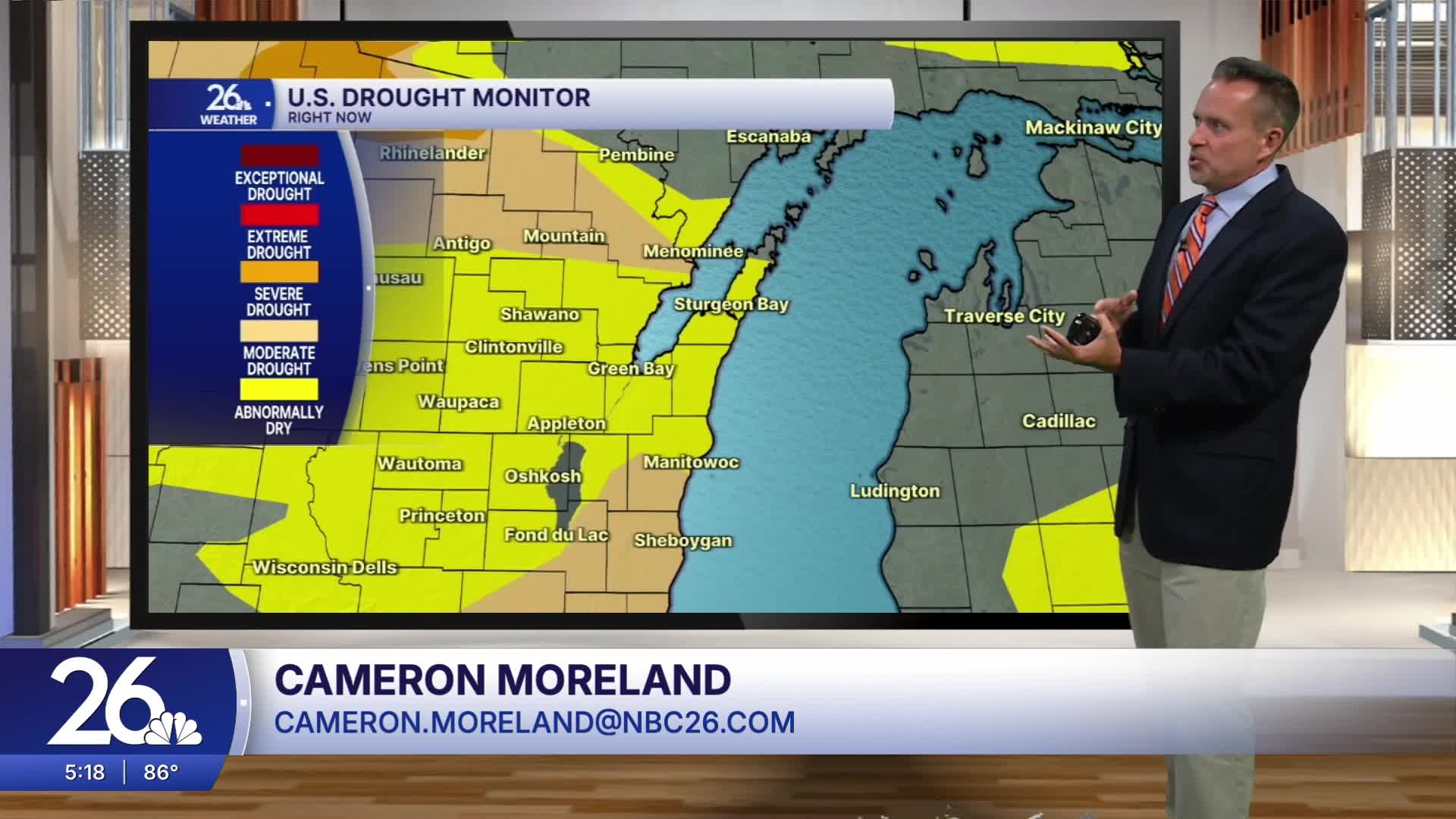
We need the rain. Drought conditions have now developed across the entire area. The heaviest totals will be south of Oshkosh, where 0.50"+ is likely.
We dry out by Sunday, with high temperatures once again reaching the upper 70s to around 80 degrees. Widespread 80s return early next week.
