

After yesterday's crazy weather, including flash flooding and hail, there were still a few leftover showers and thunderstorms across the area today.
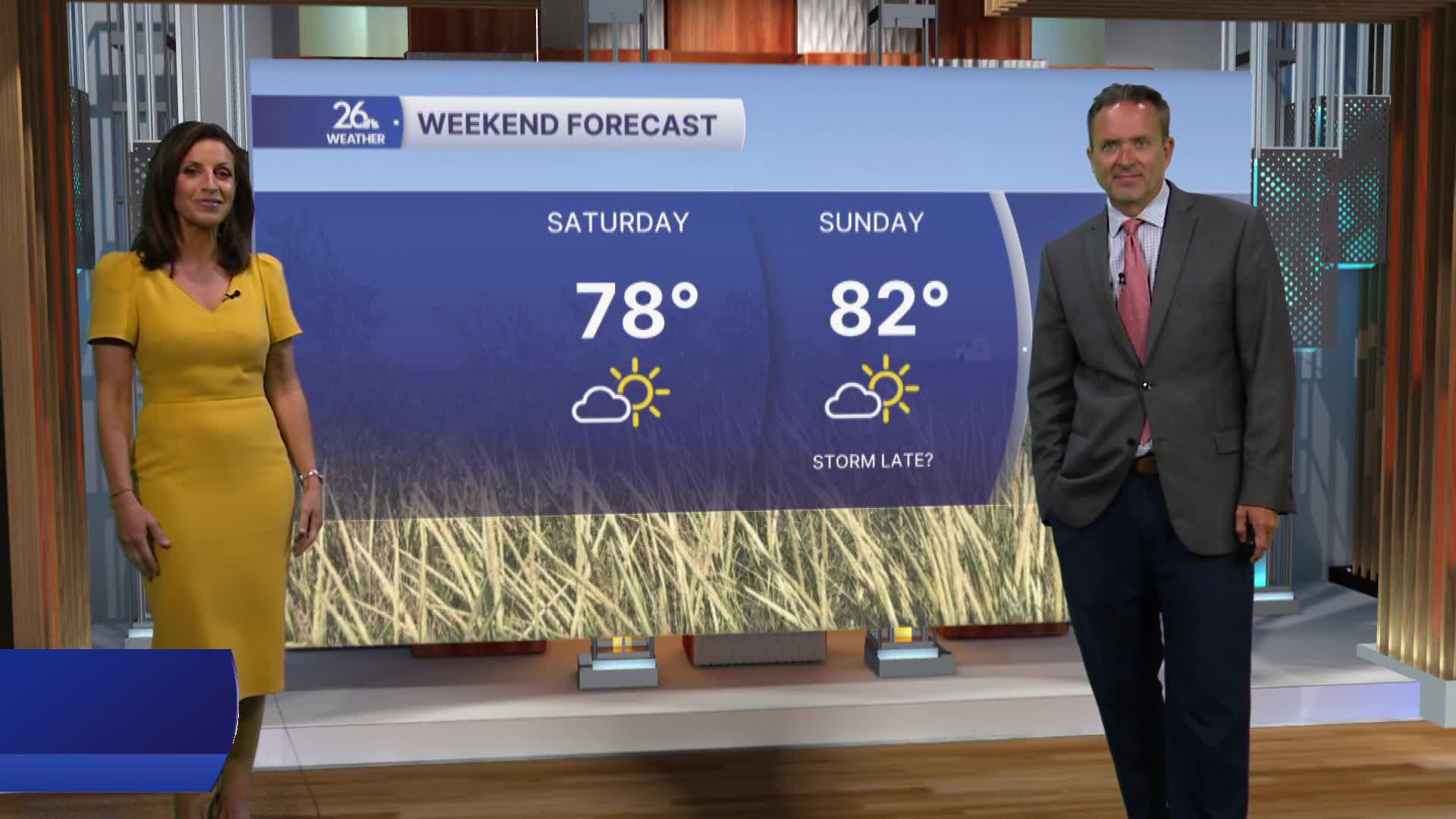
High pressure will build into Wisconsin overnight and then control our weather for most of the weekend. Expect plenty of sunshine and a warming trend.
Even though it's now officially summer, it certainly hasn't felt like it lately. We haven't reached 80 degrees since June 13, and our streak of below-normal high temperatures now stands at 12 days. We have two more cooler-than-normal days ahead before a major pattern change arrives.
A much more summer-like pattern is expected by Monday & Tuesday. High temperatures will range from the mid-80s to the mid-90s, while dew points climb into the 70s. That combination will push heat index values above 100 degrees in some locations.
The heat and humidity will stick around for much of the week, along with periodic chances for thunderstorms. Some of those storms could produce severe weather and heavy rainfall. If the storms hit during the middle of the day, the temperatures will be much cooler.
