Today was day #2 of the January Thaw!
Temperatures were in the low to mid-30s, a good 5 to 10 degrees above normal.
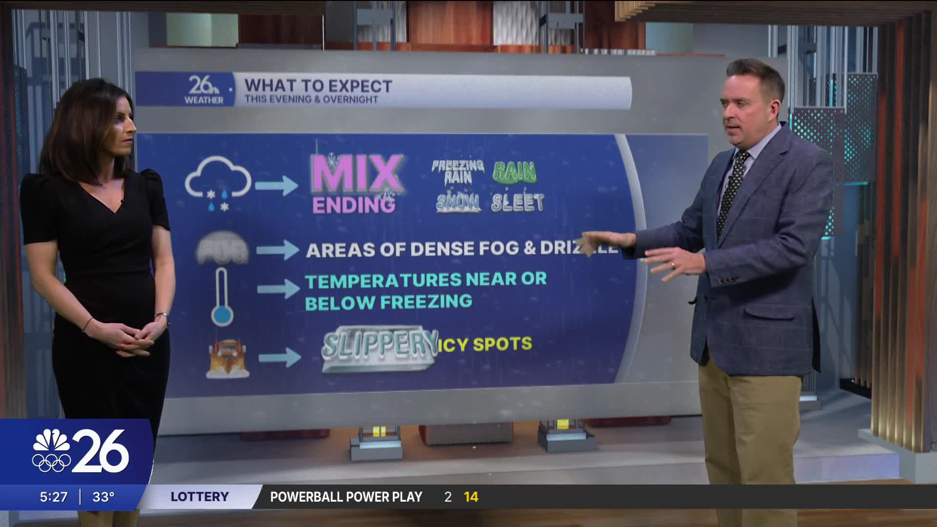
Quite often, the January Thaw is accompanied by a wintry mix & that's exactly what we got.
The bulk of the precipitation fell in the form of freezing rain or rain, which produced icy conditions.
Locally dense fog will continue into Wednesday morning. With temps near freezing, there will be icy spots.
High pressure will bring "some" sunshine to the area by late morning or afternoon.
Highs will be in the 30s through Friday, with some 40s possible.
The next chance of precipitation arrives late Thursday in the form of soaking rain.
Snow is possible on Saturday. Stay tuned!!
Cameron's Forecast


Posted
