

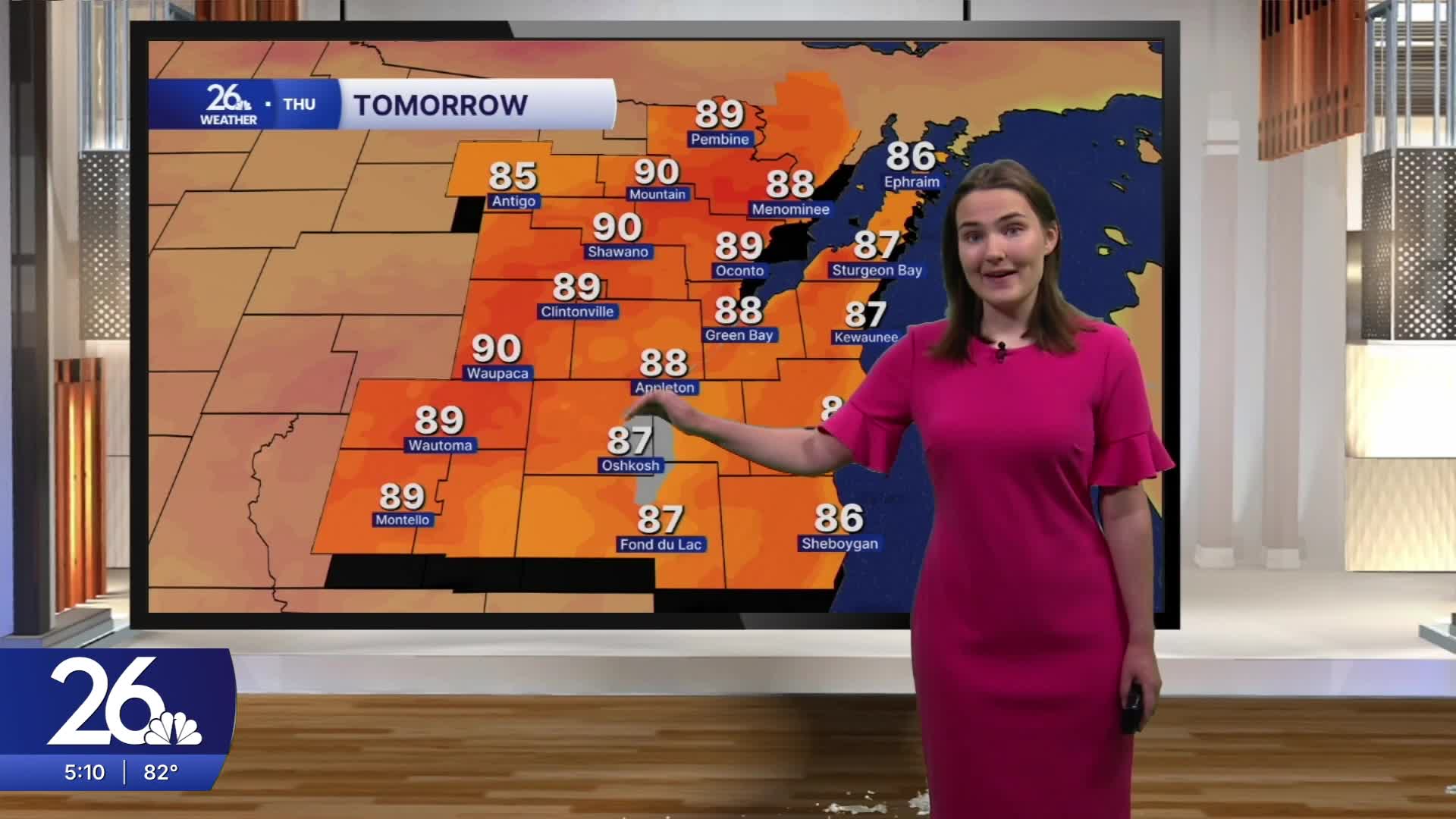


After two days of quiet, dry weather, heat and humidity return to the area on Thursday
Tonight, expect low temperatures in the low to mid 60s with crystal clear skies, although a bit of haze is possible as wildfire remains high in the atmosphere. Thursday morning will start with temperatures in the upper 60s before hotter, more humid air moves in by late morning and early afternoon. High temperatures will reach the upper 80s, with a few spots hitting 90s degrees. Dew points in the mid to upper 60s will make it feel noticeably more humid.
In addition, some of the wildfire smoke will descend into the lower parts of the atmosphere beginning late tomorrow morning. This will likely cause a slight decrease in air quality. However, it will be nothing like what we experienced a few weeks ago.
There is also a chance for a few stray showers and storms tomorrow afternoon. This threat is mainly confined to our northern counties, and not everyone will see rain as the showers weaken during the evening. Those who do see a shower or storm could experience brief heavy rainfall. A more widespread chance for showers and storms arrives Friday afternoon, with chances of showers and storms continuing through the overnight hours. Most of the rain is expected to remain south of Green Bay, with the highest rainfall totals likely across our far southwestern counties.
Relief from the heat arrives Friday as highs settle into the upper 70s and low 80s, a trend that will continue into early next week.
