

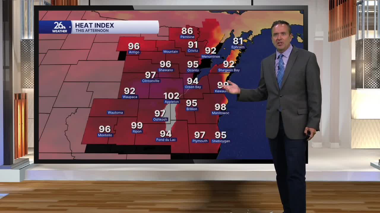


As far as weather records are concerned, today marked the final day of summer in the Northern Hemisphere—and it certainly felt like it. While our normal high sits in the upper 70s, most of us ran a good 10 to 15 degrees above normal, with temperatures topping out around 90 degrees.
But that is only half the story. Dew points climbed into the 70s, and when you combine that heat with the humidity, you get the heat index—summer's equivalent to winter's wind chill. Thanks to that moisture, it felt like it was over 100 degrees in a few locations this afternoon.
A cold front will move through overnight. Ahead of it, there is a chance for showers and thunderstorms. Any storms that manage to develop could become strong to severe, with the main threats being hail, damaging winds, and very heavy rain.
On Wednesday, expect more of the same to kick off the month of September. Temperatures will remain in the upper 80s to around 90 degrees, and with dew points staying in the 60s and 70s, it will still feel exactly like summer. On-and-off showers and thunderstorms are possible once again starting tomorrow night, continuing through the rest of the week.
Highs will drop back down into the upper 70s and lower 80s for Wednesday, Thursday, and Friday.
Looking ahead to the Labor Day weekend—the unofficial end of summer—expect upper 70s to lower 80s under a mix of sun and clouds on Saturday and Sunday, alongside a lingering chance for a shower or thunderstorm. By Monday, we will wrap up the holiday weekend with beautiful skies and highs in the 70s.
