

The area of high pressure that brought beautiful weather to Northeast Wisconsin on back-to-back days will move east this evening.
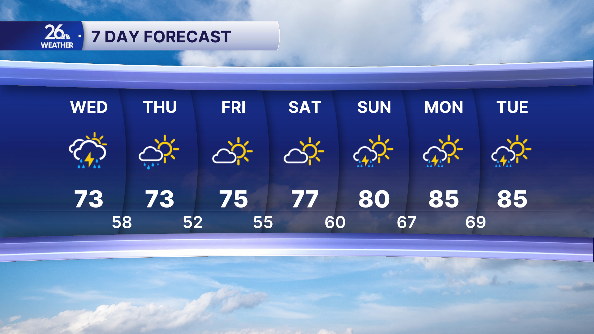
Our next weathermaker arrives tonight, bringing a chance of showers and thunderstorms. Periods of showers and storms will continue on Wednesday, and a few could become strong to severe. The main threats will be large hail, damaging winds, and heavy rainfall.
Even though it is now summer, it certainly hasn't felt like it lately. We haven't reached 80 degrees since June 13, and our stretch of below-normal high temperatures has now reached nine days. We have four more below-normal days ahead before a change arrives.
A much more summer-like pattern is expected as we head into next week. Heat and humidity will be in place for much of the week, along with periodic chances for thunderstorms.
