Monday was the warmest day in five months!
Record highs were broken as temperatures climbed into the 60s and 70s.
But that marks the end of spring weather for the foreseeable future.
A strong cold front moving through overnight will send us back to winter.
Gusty northeast winds will lower temperatures into the 30s and 40s.
A patchy wintry mix is possible on Tuesday, especially north of Green Bay.
Showers and a few storms will develop later in the day, further south.
Some storms could be strong, bringing hail and heavy rain.
The wintry mix will turn to snow on Wednesday, with a dusting to a few inches of snow possible.
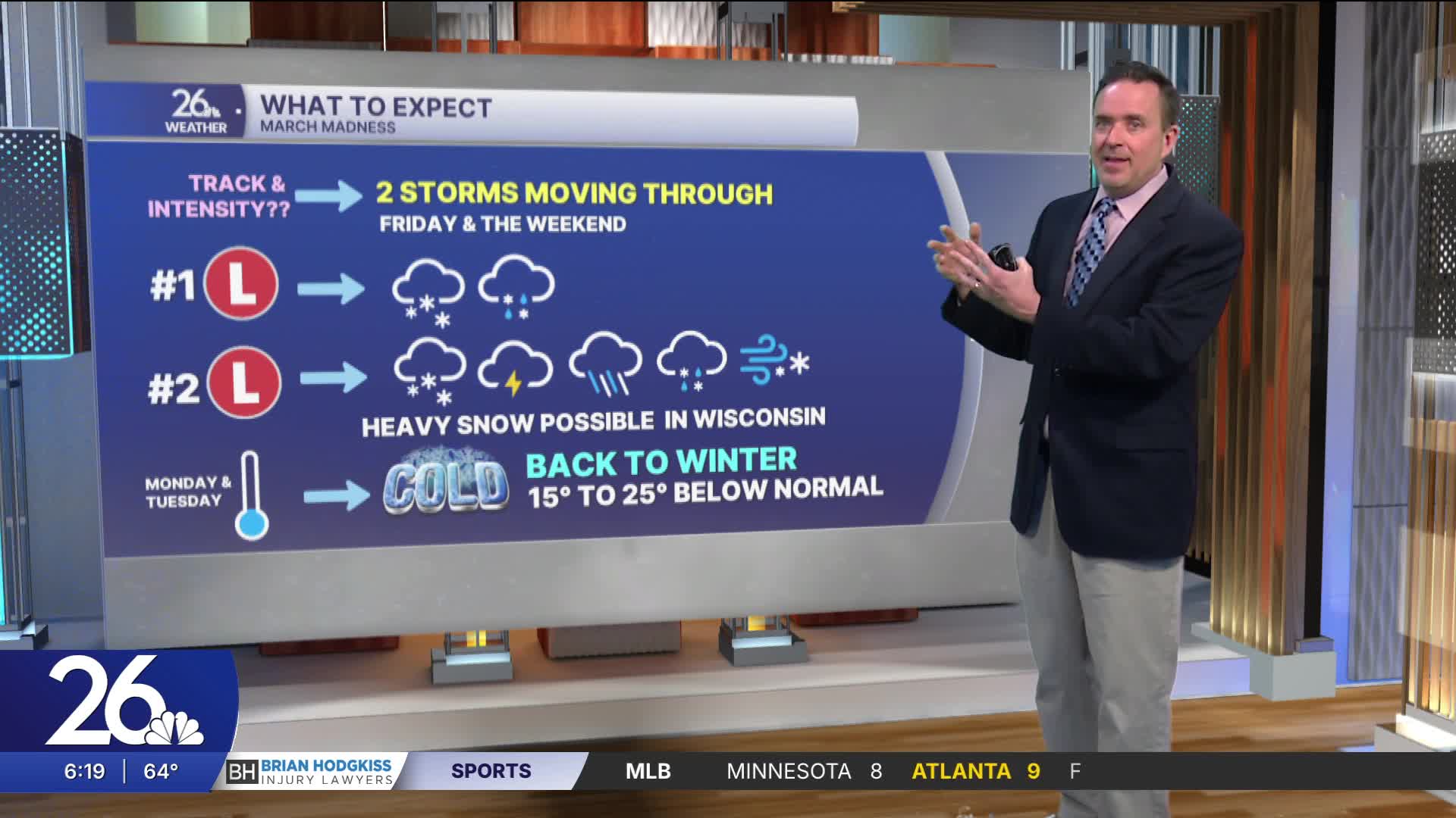
After a break on Thursday, another storm will bring snow back to the area on Friday.
A potentially much larger winter storm might be heading our way for the weekend. Stay tuned!
Cameron's Forecast


Posted
and last updated
