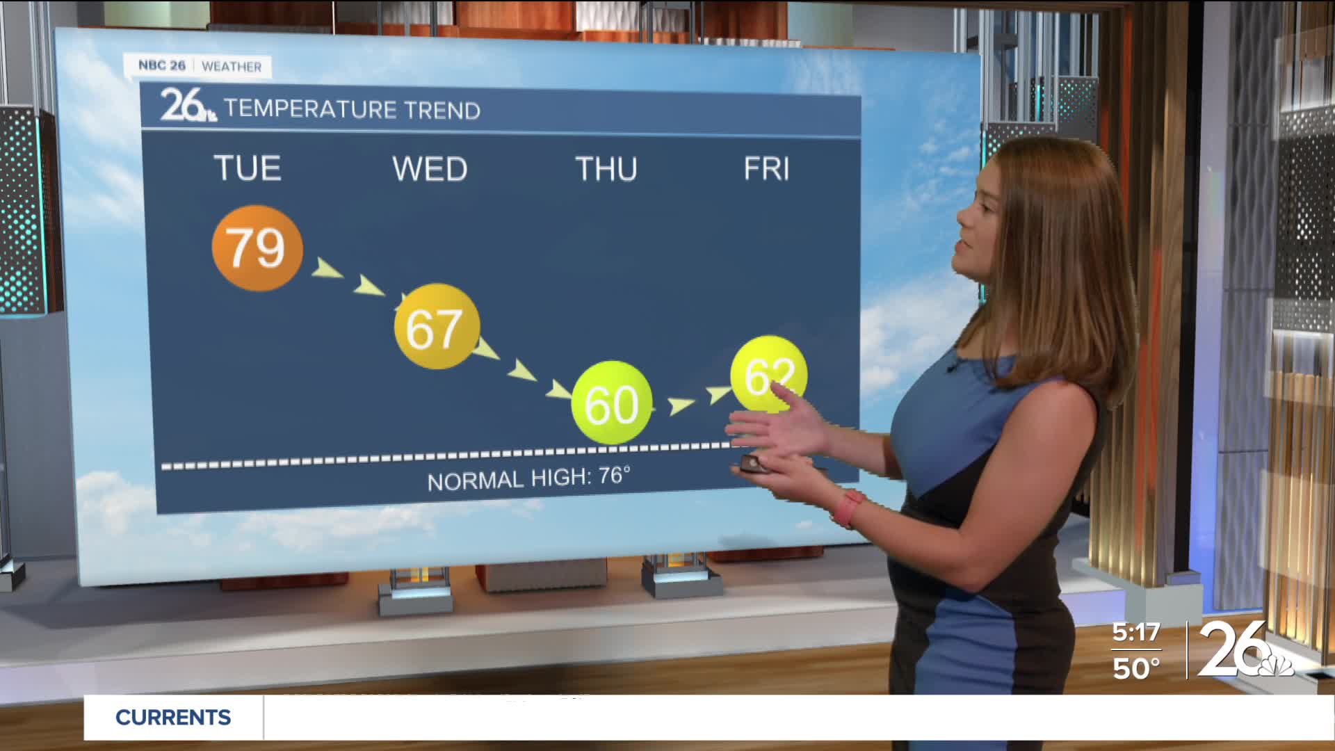
Locally dense fog out there early this morning will dissipate and lead to another mostly sunny and mild day across NE WI with highs in the upper 70s. Showers and isolated storms roll in tonight and continue into Wednesday morning. Showers will become more isolated Wednesday afternoon with highs only reaching the mid 60s. Temps may only reach 60° on Thursday, which would break the record cold high temp for that date of 61°.


Posted
